

What are tides?
If you've ever been to the coast, you're probably familiar with tides. They're the daily rise and fall of the sea level, something that usually happens twice a day. The change in water level, or tidal range, varies a lot around the world. In many places, it's just a couple of meters. But thanks to some unique features of our coastline and ocean depth, the UK has some of the biggest tides on the planet. The Severn Estuary and the area near Liverpool can see a difference of over 10 meters in height.
Tides are a big deal for coastal life. They determine when ships can get into ports and can even pose a risk of coastal flooding. On gently sloping coastlines, a falling tide can retreat a long way, leaving wide areas of beach and mudflat exposed. This is an important food source for wildlife. The timing and height of the tide change daily and vary along the coast, and these patterns can shift as the coastline itself changes over time.

How does NOC help predict tides?
Predicting the exact timing and height of tides can be tricky in some locations. At NOC, we develop advanced tidal models that use information about the sun and moon's positions to help coastal managers and infrastructure operators. These models produce reliable predictions months or even years in advance.
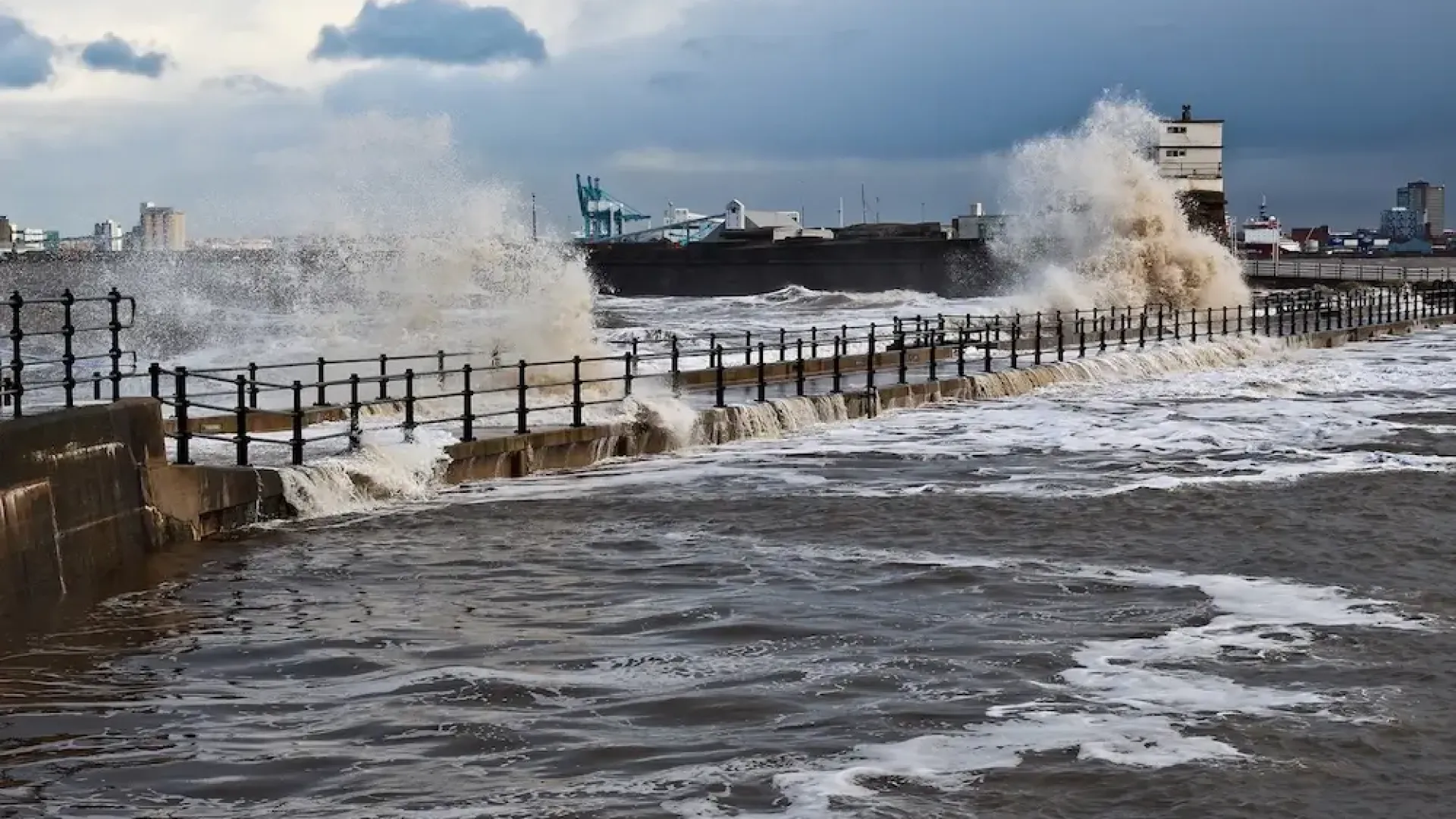
Storm Surges and Coastal Flood Risk
Storm surges happen when the weather changes the sea level, affecting the normal height and timing of the tide. High atmospheric pressure pushes down on the sea, while low pressure allows it to rise, about 1cm for every millibar of pressure change. Strong storm winds can also cause water to pile up against the coast for a few days.
In parts of the world with tropical cyclones, this effect can cause the average sea level to rise by several meters above the usual tidal range. Here in the UK, we see storm surges of about 1 meter a few times a year, especially in the North Sea between East Anglia and the Netherlands.
We work closely with the Met Office and the Environment Agency to improve the forecasting of surge events. This research helps local managers know exactly when to deploy or implement flood management schemes, from massive projects like the Thames Barrier down to hand-operated local gates.
Looking further ahead, we also help estimate future flood risks. We work to answer crucial questions like, "How often will floods happen?" and "What's the best way to protect people and their homes?" We do this work both in the UK and around the world, supporting communities with local modeling and observations.
How are waves made and how do they travel?
Wind doesn't just contribute to storm surges; it also creates waves on the sea's surface. The longer and stronger the wind blows, the bigger the waves get. What starts as short, choppy "wind-sea" waves can grow into smooth, rolling "swell" waves as they travel away from the storm that created them. These swells can travel huge distances across the ocean until they lose their energy, often hitting land far from where they were generated.
Waves lose energy from friction with the seabed and by breaking in shallow water or at the coast. When they reach the shore, they can become a hazard as they run up or crash over natural and man-made barriers.
Waves are a major contributor to coastal flooding and erosion. They can damage infrastructure by putting immense pressure on structures or by throwing debris like pebbles and driftwood over them. High waves can overtop coastal defenses, while energetic waves can move seabed sediments and erode beaches and cliffs.

Why is understanding waves so important for activity at sea?
Understanding waves is also vital for safety at sea. Stormy conditions can make shipping and offshore work dangerous, so knowing the wave "climate" is essential when designing everything from offshore structures and vessels to planning shipping routes.

Are tides and waves being looked at as an energy source?
Yes, both tides and waves are being explored as resources for future renewable energy. The UK has a massive, largely untapped resource for tide and wave energy, with great potential for development in the future.
How We Measure Tides, Surges, and Waves
We measure both tides and storm surges with instruments called tide gauges. NOC has developed a whole suite of specialist installations for this. We use everything from bubbler gauges for challenging tidal ranges and heated stilling wells for measuring tides through Antarctic ice, to solar-powered radar gauges and GNSS reflectometry (GNSS is the general term for systems like GPS).
We create models of tides, waves, and surges to help predict them. These models are combined with real-world observations to better understand the processes at play and make projections for the future. Our models can simulate waves across the entire global ocean, as well as overtopping events right at the coast and everything in-between. These models are what underpin the Environment Agency's official surge forecast.
Absolutely. Tides, waves, and surges can also be monitored from space. We use the latest satellite observations from projects like SWOT and CCI, as well as data from ship-based and shore-based radar systems.
We monitor direct coastal impacts through the WireWall project. We use this data to create hazard dashboards to share information, which are available at coastalhazards.app.noc.ac.uk. This allows others to access the data for their own uses, like training new predictive tools. We also develop digital platforms to integrate this coastal hazard data with other ocean observations.
Our authors contribute to the Marine Climate Change Impacts Partnership (MCCIP), which publishes report cards on the latest research. Examples include reports on waves and storms and coastal flooding.
Read the MCCIP ReportWhen people think about sea-level rise, the biggest worry is often future coastal flooding. It's important to frame the problem correctly. The question usually isn't, "Will this place be underwater?" but rather, "How much more often will this place flood than it does now?" Many land areas are already lower than the highest tides, but are kept dry by carefully managing embankments, drainage, and pumps. Other areas only flood on rare occasions when a surge and high tide coincide. As the sea level rises, these rare events will happen more frequently, and the cost of protecting these areas will increase. NOC projects considering future extreme sea levels as the climate changes include AtlantiS.
Projects on Storms, Tides and Waves


Publications
Williams, Joanne  ORCID: https://orcid.org/0000-0002-8421-4481.
2025
The UK Storm Surges of 2024.
Southampton, National Oceanography Centre, 43pp.
(National Oceanography Centre Internal Document, No. 30)
ORCID: https://orcid.org/0000-0002-8421-4481.
2025
The UK Storm Surges of 2024.
Southampton, National Oceanography Centre, 43pp.
(National Oceanography Centre Internal Document, No. 30)
2025
Monograph
Kendon, Mike; Doherty, Amy; Hollis, Dan; Emily, Carlisle; Stephen, Packman; McCarthy, Mark; Jevrejeva, Svetlana ORCID: https://orcid.org/0000-0001-9490-4665; Matthews, Andrew ORCID: https://orcid.org/0000-0001-5210-2453; Williams, Joanne ORCID: https://orcid.org/0000-0002-8421-4481; Garforth, Judith; Sparks, Tim.
2024
State of the UK Climate 2023.
International Journal of Climatology, 44 (S1).
1-121.
10.1002/joc.8553
2024
Article

Interested in learning more?
Explore how tsunamis impact coastal communities and ocean systems.